I started mid-July in Keflavík, Iceland's international airport (about 50km southwest of the capital Reykjavík).
I was eager to get started and the weather did not invite me to stay, so I cycled past the Blue Lagoon to Grindavík. Grindavík is one of Iceland's most important fishing villages. Herring, capelin, sea wolf and cod are caught and processed for many centuries, just the processing methods have changed: until the 19th century the fish was dried, then it was put in salt and now it is frozen. A museum provides information on fishing and processing methods.
 .
.
Crossing various lava fields along the coast and via Þorlákshöfn to Selfoss, a small village well suited to fill up your supplies.
 .
.
Heading east, and leaving Selfoss, I cintinued on the famous Hringvegur (Ring Road) or Þjóðvegur (national road), and passed the mightiest waterfall of Iceland, the Urriðafoss. The river Þjórsá delivers about 360 m³ / s from the highlands.
 .
.
No more sunshine, the Seljalandsfoss showed itself from its dark side. Nevertheless, many tourists were there for a visit and you can walk on a path behind the waterfall (depending on the wind direction and strength you can get quite soaked). At the end of the trip I will be able to show some pictures of this waterfall with sunshine ...
 .
.
In the last weeks before I arrived in Iceland, early July, there was a lot of rain in Iceland and that was probably the reason that on the way to Þórsmörk all the fords were filled with deep water.
 .
.
A small highland gravel road close to Seljalandsfoss leads Þórsmörk. This gravel road is a dead end for bicycles, so you have to cycle back around 40km.
 .
.
Þórsmörk is located between the rivers Krossá, Þröngá and Markarfljót.
 .
.
A popular trekking route, the Laugavegur (Icelandic for hot springs) leads from Skógar on the south coast via Þórsmörk to Landmannalaugar.
 .
.
In the afternoon and the following morning I made short hikes into the surrounding mountains. The limited visibility and later the rain drove me back to the main road.
 .
.
The bad weather, the bumpy slope (on which the screws of my luggage rack were loosened by the shaking) and the abovementioned deep forts, gave me a certain respect for the highlands of Iceland.
(2) Skógafoss and Vik
Completely soaked I arrived in Skógar around noon; A warm soup and a dry room were more attractive than the Skógafoss (you have probably already noticed it: foss means waterfall) and the open-air museum Byggðasafnið að Skógum.
 .
.
In Vik, Iceland's southernmost settlement, I stayed on the camp ground and was able to warm-up in the crowded large communal kitchen. Vik has a nice swimming pool with 40 degrees hot tubs, also called hot pot, which I visited in the evening with 2 French and a Belgian girl from the campsite. These hot pots are extremely pleasant when it rains in the evening, the thermometer shows just 7 degrees, fog and a light drizzle, and after a long stay, the whole body is so full of warmth that it is enough for a dinner in T-shirt until its time for your sleeping bag.
 .
.
Vik has a very nice black lava beach and the rocks reynisdrangar, skessudrangur, landdrangur and langsamur off the coast are petrified trolls who wanted to bring a ship ashore.

(3) Mýrdalssandur and other outwash plains
On the ring road to the east, I cycled through the outwash plain Mýrdalssandur, that was formed by Mýrdalsjökull (jökull is Icelandic for glaciers) and
 .
.
through huge fields of Lupinus nootkatensis. Until 1550 Kirkjubæjarklaustur was a nunnery, the waterfall Systrafoss was named of the sisters. I did not much sightseeing there but was hungry and decided for an Icelandic specialty: pylsa með öllu, this is a sausage factory mostly from the sausage factory Sláturfélag Suðurland caontaining lamb which is served as an hot dog with onions and sauce.
 .
.

 .
.
(4) Skaftafell and Svartifoss
Feeling strong after that sausage I enjoyed in Kirkjubæjarklaustur, I hiked in the Skaftafell National Park to the waterfall Svartifoss, which flows down in front of black basal columns. Due to the countless tourists in the afternoon I cut my stay short and continued to a campground a few kilometers south of the national park center.
 .
.
 .
.
 .
.

5 Jökulsárlón
Unfortunately no more sunshine for a while. Breiðamerkurjökull is calving ice in the glacial lake Jökulsárlón. A short river connects the lake with the sea and the icebergs drift from the lake into the sea. Some icebergs do not go on a big trip, but stay on the beach in the black basalt sand.
The Jökulsárlón is a popular filming location for cinema productions, e.g. the James Bond films A View to a Kill and Die Another Day, as well as Batman Begins, Beowulf and Grendel, and Lara Croft: Tomb Raider.
 .
.
 .
.
In the evening I stayed in Höfn and visited again (gradually I realized that this should be less a bike trip than a pool holiday) the swimming pool there. It was open until 9 pm and featured to my pleasure several water slides. As you can see on the following pictures along the coast to Djúpivogur and Breiðdalsvík (vík = bay, so the bay of the wide valley) there was abundant fog.
 .
.
 .
.
 .
.
(6) Fjords of the east
I found a small campground in Breiðdalsvík behind a small hotel (and a swimming pool). I met an American there who wanted to explore Europe by bike for a year and had apparently earned his money in Colorado by turning the ground floor of his house purchased for credit into a greenhouse for certain plants. On November 6, 2012, Colorado's Amendment 64 ruined his business and he decided to try to ride a bike.

 .
.
The weather improved next morning and I cycled to Stöðvarfjörður, Fáskrúðsfjörður and Reyðarfjörður, you probably guessed it: fjörður can be translated with Fjord.
 .
.
 .
.
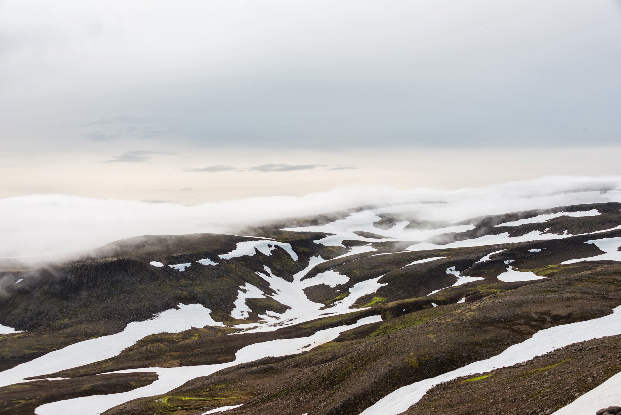
Up north means a bit uphill, and you reach a little the pass at 350m. Egilsstaðir was the first bigger village on my way for days (but I did not take any pictures worth mentioning). I originally planned to head into the highlands from here, but the weather forecast for the next days were miserable and so I decided to stay on good roads and visit the north-east of Iceland. From the main road I turned to road 917
 .
.
And cycled over the Hellisheiði a 730m high pass to Vopnafjörður.
 .
.
As you can see in the pictures the views can be limited and heat is not your problem
 .
.
 .
.
 .
.
The roads were mostly gravel in the north-east and since the weather was wet most of the time I took only a few pictures on my way to Þórshöfn (swimming pool). The small campsite was occupied with motorized tourists, especially motorcyclists who had just arrived by ferry Norröna in Seyðisfjörður (from Denmark via the Faroe Islands to Iceland).
 .
.

The next morning I made my way across the Kópasker to Ásbyrgi and Dettifoss.
(7) Ásbyrgi and (8) Dettifoss
It is told that Odin's eight-legged horse Sleipnir had left his hoof print here, and created the horseshoe-shaped valley. I stayed there in the campsite and made a bike trip to Dettifoss in Jökulsárgljúfur National Park in the evening.
 .
.
 .
.
 .
.
 .
.
(9) Húsavik
The Swedish Viking Garðar Svavarson hibernated 875 in Húsavik and reached probably Iceland before Ingólfur Arnarson. He named the island after himself Garðarsholmur, but that didnt catch on as we can see now. Húsavik at the Skjálfandi bay offer whale watching tours in small ships.
 .
.
 .
.
 .
.
I saw five humpback whales overall during the 3 hour ride. Here are a few of many similar pictures. The individual whales can be kept apart from the drawing on the underside of their tail fins.
 .
. .
. .
.
 .
. .
. .
.